
|
| ||
Last updated on 12/05/04 |
|
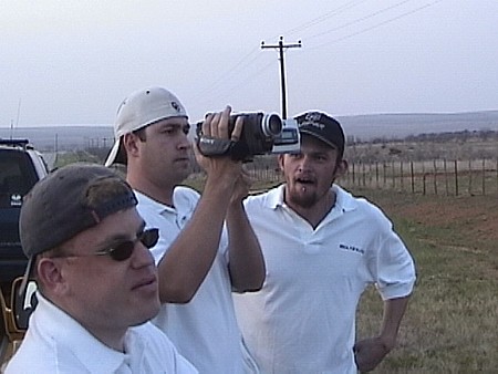
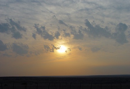
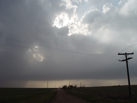
MY BLOG WITH 2006 CHASE SUMMARIES CHASE SUMMARIES OF 2003 4-5-03 Storm Prediction Center had a moderate risk for southern OK and northern TX. Started off the day in Paducah, TX which is located south of Childress.(We waited around) for storms to develop but nothing was happening. It got late in the day and we thought that we would be losing light before we saw any storms going up. At about 6:30(we saw a storm) developing to our southeast. It was not too far away but our lighting was dwindling pretty fast as it got late in the day. We just decided to stay put and(take some video) of the developing storm. This was not the best chase day but at least we got out and waited to see what Mother Nature had in store for us. It got late and we saw a(nice sunset) and snapped a few shots of it and went home.
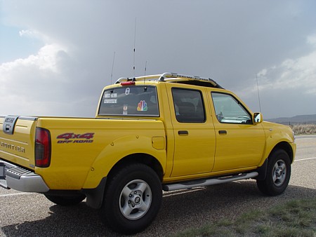
4-15-03 Storm Prediction Center had a moderate risk for the extreme Eastern TX panhandle along with Western OK and Southern KS. Headed to Pampa, TX from Amarillo and then went on up to Perryton, TX. The southeasterly surface winds were very strong and I decided to get out and see how strong they were blowing. I got my Kestrel out and the winds were sustained at about 20 to 25 knots. I decided while I was out that I would get a shot of (my truck) with storms in the background. We drove a few miles East out of Perryton and I(got a shot) of some of the storms trying to mature. Overall this day was a bad day with lots of storms going up all around us which hurt our visibility and we never really saw anything of interest despite the moderate risk for this area.
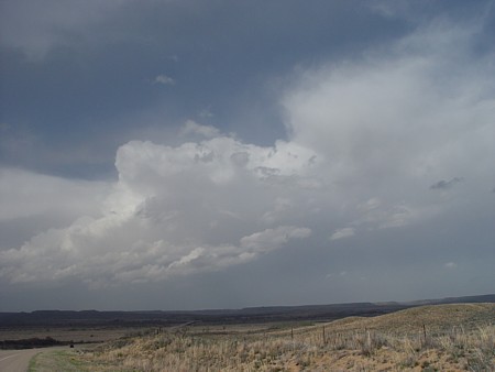
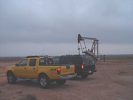
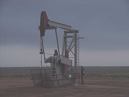
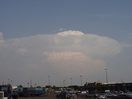
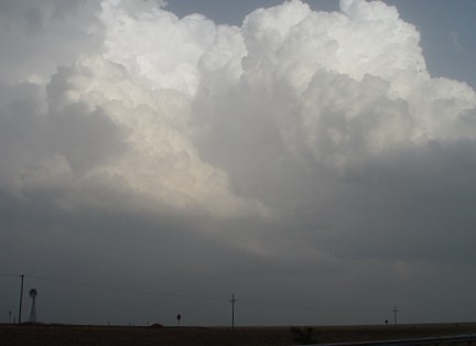
4-22-03 Storm Prediction Center had a slight risk for most of TX except for extreme Southern TX and the big bend area. The tornado potential which was 2% was located west of Lubbock, and after some forecasting Dan Skoff and I headed west of Lubbock. We ended up in Brownfield with(storms) trying to fire. The wind shear was very good as the low level clouds were streaming to the NW while the mid-level clouds were streaming to the NE. We waited in Brownfield for another hour or so and we never saw any good storms develop. The storms that did try to fire ended up dissipating after a while. We then looked to our Southwest and saw something in the sky that made us very excited. We rushed a couple of miles south and then a block or so west and low and behold we saw the best thing that we had seen in (the sky all day. ). We ate here and sat around for about 30 minutes waiting for storms to fire. When we left, Dan gave me his thoughts (for the chase day) . After Dan's ranking we thought we might go South of town and try to at least get some lightning shots. We sat here (and waited patiently ) for some distant lightning shots. We never saw any so we decided to take shots with our digital cameras of this (oil well). We took a few shots, shook hands and said, "oh well that's how it goes sometimes" and then drove back to Amarillo.
4-23-03 Storm Prediction Center had a moderate risk for an area of about 50-75 miles or so in either direction from Wichita Falls. I chased by myself on this day. Dan Skoff woke me up at about 11am and told me the synopsis of the day and said I might want to get going. I quickly took a shower and got my things together. Dan had to work on this day or he would have gone with me. I went down 287 toward Clarendon when I saw (these storms) going up to my East and Southeast. As I was going through Memphis I got caught behind a wide load vehicle. I lost a lot of time in town behind this guy and finally broke free on the southern edge of town. I ended up in Seymour and saw a fairly (nice storm) to the west of town. As I was taking still shots and video, the same (wide load) that I saw in Memphis was now in Seymour! I just had to laugh as I thought this was pretty ironic. Needless to say I went the opposite direction. I then headed North of town to get a better glimpse of this storm which looked fairly impressive. It had a good base on it but it was really low topped and not rotating from my point of view. It also had a good inflow band going into the updraft. I followed this storm until it moved off and began to dissipate. I then went to Wichita Falls to eat and then proceeded home.
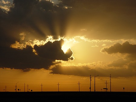
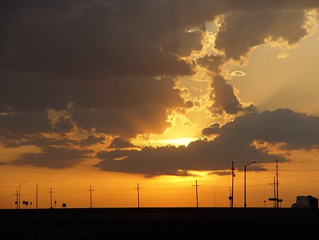
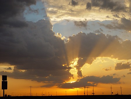
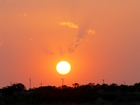
4-28-03 Storm Prediction Center had a slight risk for most all of West Texas. This day was not the set-up for a great day but I thought I would go out and see what happened. I headed South on I-27 out of Amarillo. I started seeing some updrafts (near Silverton) . These updrafts looked impressive for a while but developed into multicellular looking storms. I stopped in Plainview for a while and (saw a storm ) forming to the North of Amarillo. It looked pretty good and as no storms were forming around my area I thought I would head back to Amarillo. When I got to Amarillo the storm didn't look that impressive. It had pretty much dissipated but gave me enough cloud cover to get some pretty good sunset shots. See (sunset1) (sunset2) and (sunset3). After I took these photos I went home.
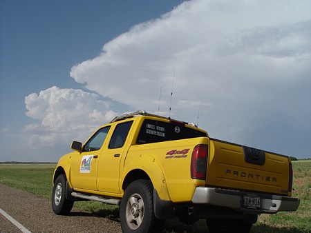
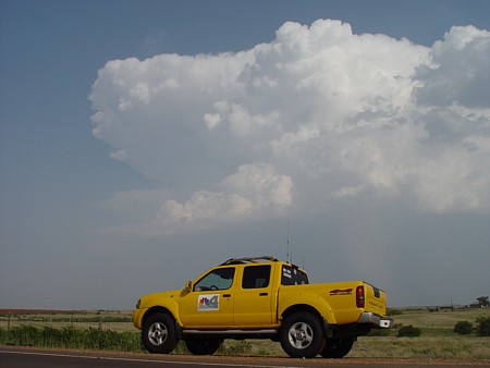
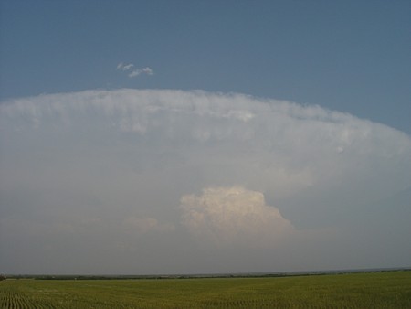
4-29-03 Storm Prediction Center had a slight risk for all of West Texas. This day was nothing special but I thought I would go out and see what happened. I was off and had nothing better to do! I headed down I-27 towards Tulia. I saw a storm firing near Silverton so I headed East out of Tulia and got to the storm. It was nothing spectacular but I got a shot (of the anvil) . I also got a shot of the (rain falling) from the storm. The storm dissipated and I saw a storm go up South of Memphis. I headed that direction and saw the storm. It didn't look too bad so I pulled over and got some shots of the storm along with a shot (of my truck) with the storm in the background. The storm moved on without producing anything interesting like a wall cloud so I headed into the town of Memphis. I got back on 287 and started to head back to Amarillo when I saw a nice scene (with a rainbow) so I decided to stop and take a few photos. I then started toward Amarillo again and pulled over one more time to get a shot of the clouds (with the setting sun) .
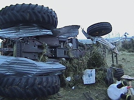
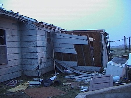
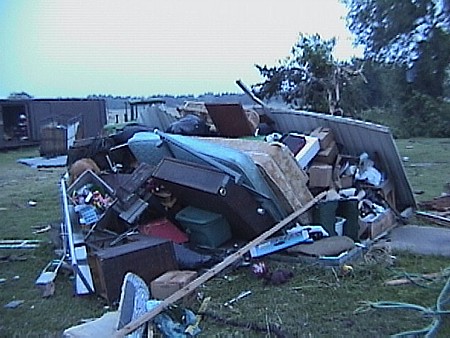
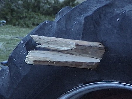
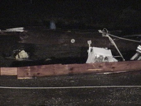
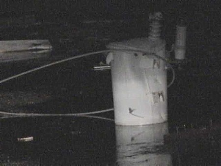
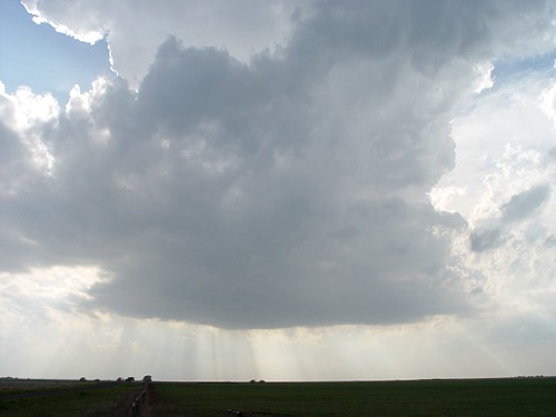
5-7and morning of 8th-03 Storm Prediction Center had a slight risk for most of the Eastern TX panhandle and the red river valley. I left Amarillo around 5pm and headed down 287 towards Childress. When I got to Childress I went South to Paducah. I sat in Paducah for about 45 minutes and a weak looking storm began to go up to the West. It didn't look too impressive but this was the only storm in the area so I sat and waited. After a while I noticed a rain free base taking shape and I also noticed some (striations in the base) of the storm. I started getting excited at that point. I called back to the station and Keith Monday, the head meteorologist told me that the storm was definitely rotating. I verified the rotation to him by telling him that I did see striations in the base of the storm. This storm was to our West and moving NE so we were in great position being to the E/SE of the storm. After an hour or so the storm finally died out when it was NE of our location. Right at sunset the storm was gone but we witnessed a nice (sunset). Dan Skoff had been around Plainview and he met us in Paducah about 10pm or so. We sat in Paducah waiting for storms to fire and we began seeing a ton of lightning to our East. We decided to go after it. We headed East towards Crowell and between Crowell and Vernon Dan called and said the storm now had a tornado warning on it. We then got to Vernon and went SE towards Wichita Falls. We kept going until we hit I-35 and then we went North on I-35. There were more storms in this area going up and they were going tornadic very quickly. We listened to the Weather radio and we had a tornadic storm pretty close to us. It was obviously dark now so it was hard to chase especially since we were in unfamiliar territory. There was a tornadic storm between Marietta and Madill, OK. We were really close to the storm so we got on it. There was probably more lightning with this storm than any I have ever seen. There were CG's hitting close to us every 2 or 3 seconds. BOOM, BOOM, BOOM, it sounded like cannons going off. By this time it was at least 2 in the morning! We followed the storm to McAlester or so until we either got tired or the storm fizzled out. I really don't remember. We sat in McAlester for a few minutes and decided to head home. I went back the same way I had come to try to get some tornado damage. Dan was really tired so we split off and he went back home the quickest route he knew. As I got to Madill it was about 5am or so. I was driving down the road and saw ambulances near a farmhouse. I knew there was tornado damage there because the storm was the strongest when it was at that location. I pulled in and asked who was the owner of the house. I found out and went over to ask the farmer if he was ok. He said yes and I introduced myself. I told him I was with a TV station in Amarillo and wondered if he would mind if I got some video. He said sure, go ahead. I ALWAYS make it a point to ask if I can take video. It is extremely rude to go onto someone's property that has just been devastated by a tornado and start taking video, assuming that it's ok. Always be polite and ask. If the person says no then tell them your glad their ok and leave. Ok, back to the story. At this point I started taking video. The first thing I noticed was (this tractor) which was about 30 feet from the farmer's house. He said that he bailed hay the previous day and the tractor was about 150 yards out in his field. I continued to walk around and got video of (his house) which was badly damaged. I continued walking around and saw these (belongings ) just piled up in the yard. I walked over to a tractor that had not been moved by the tornado but I saw something very interesting. I looked at the tire and saw a (board) stuck in one of the tires! This was really amazing to me as I had never witnessed something like this in person before. I finished up the video and walked over to the farmer and his wife which were both ok and told them I was very glad they were not hurt. They were very nice people and I hated to see their property get damaged the way it did. With the attitude they had and the happy spirit they possessed, I bet it didn't take long at all for them to get back on their feet. The best part of this chase was finding out that the couple was ok and that their house was not completely wiped away by the fury of that tornado on that dreadful May morning. (By the way, this was the longest chase ever for me)!!
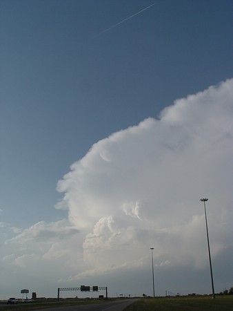
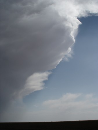
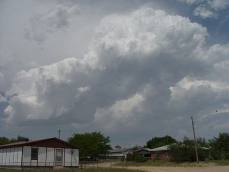
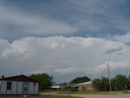
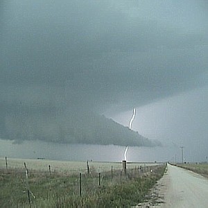
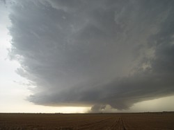
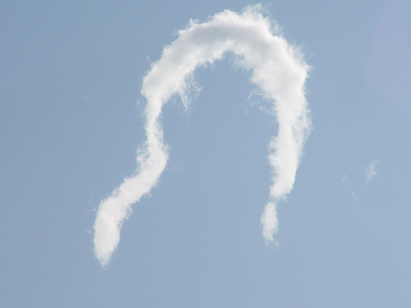
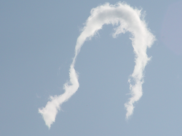
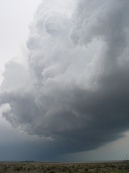
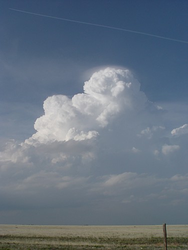
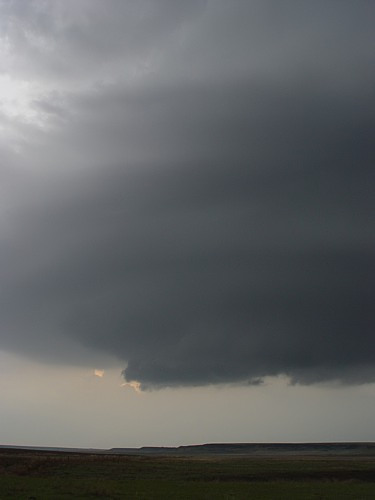
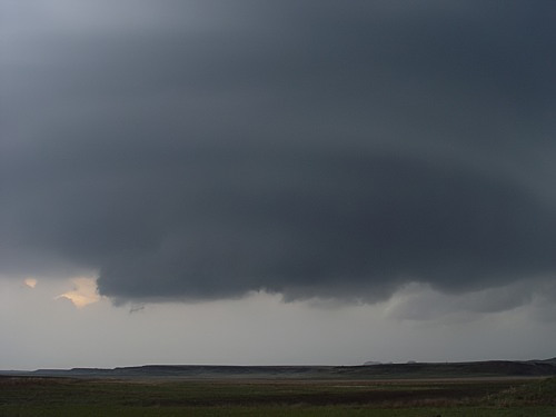
5-9-03 Storm Prediction Center had a slight risk for the extreme Eastern TX panhandle and a moderate risk in central Oklahoma. On this day I decided to go near Ok City to get into the best area for severe weather. At about 1pm I headed to Ok City. I got to Ok City at about 3:30 or so and a storm had already gone up NW of Ok City around the city of Okarche. This storm really never got its act together until it passed to the NE of Guthrie around the city of Coyle. It then began to show signs of (producing a base) as it passed to the North of Coyle. The base stayed sustained for a while but never did anything more interesting as it slowly drifted to the NE. I didn't have very good road access so I drifted back towards Guthrie. As I went West of Guthrie I saw a storm that has just went severe. It didn't look too bad so I went after it. I found my way onto highway 74 West of Guthrie near Cimarron City. I noticed the storm to my NW and it looked like it had a pretty good base. As it drifted closer I got excited because it displayed a (very good base) and it was very low. I kept heading North and the base got (even lower) and produced a very nice tail cloud. A few minutes later (this wall cloud), (became very well developed) but it never had any tornadic rotation with it. It still looked very nice as I took a lot of photos and video of this. I followed this wall cloud for about an hour or so and it finally produced a brief funnel near Highland Park. I continued to follow this storm as it finally began to decrease in intensity a half hour later. No other storms formed and it began to get dark so I began the long journey back to Amarillo.
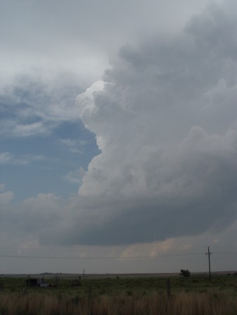
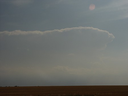
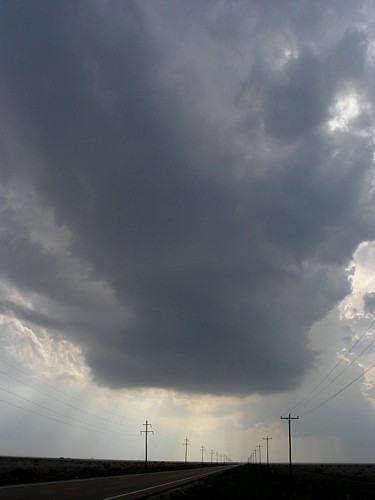
5-13-03 Had a slight risk in the extreme Eastern TX panhandle. Decided to go out even though the day really didn't look to promising. I made my way to Childress from Amarillo and then went south about 10 miles or so after seeing a storm going up. I then headed a little further south but this storm never produced anything but pea size hail. I then began heading North again towards Childress and saw a (storm going up ) to the SE of Childress. It looked ok, about what I expected for this day so I sat and just watched it. It moved off and I began following it as I went SE on 287 out of Childress. It began to take on a good (symmetrical look to the anvil). After a few more minutes it began to produce an (overshooting top) . It dissipated not long after this so I went home because there were no other storms in the area.
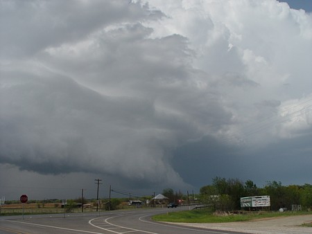
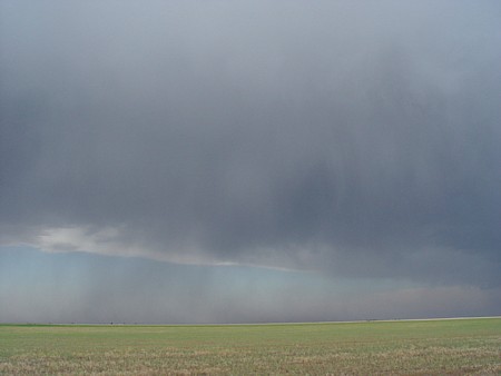
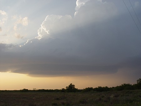
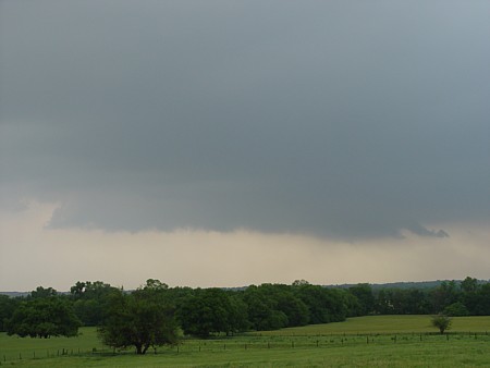
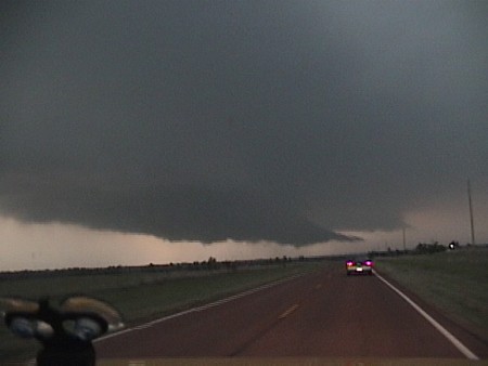
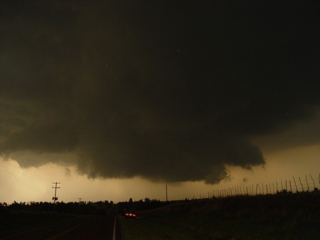
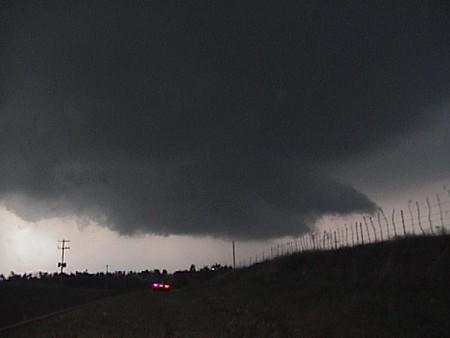
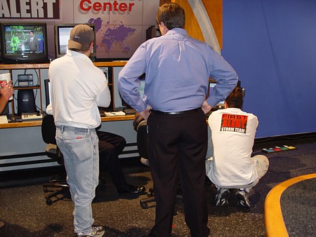
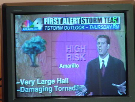
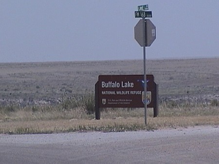
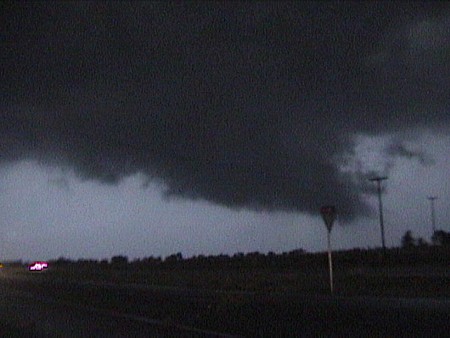
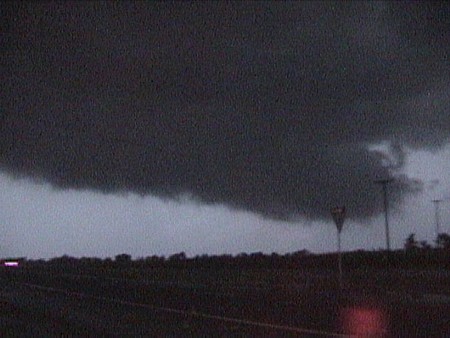
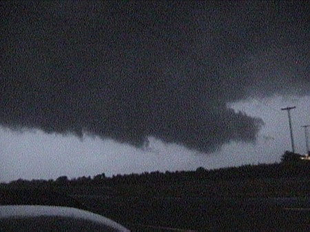
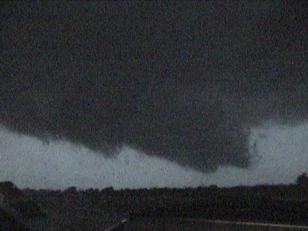
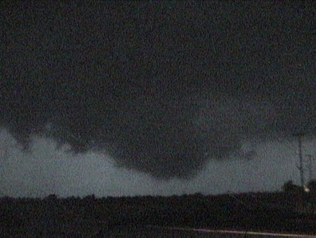
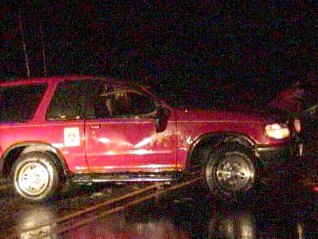
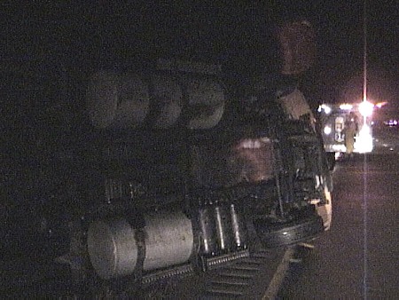
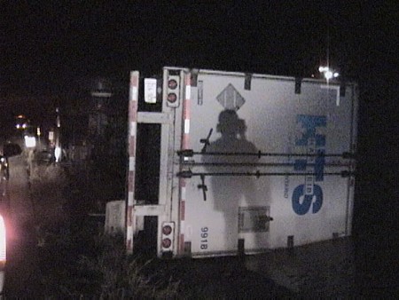
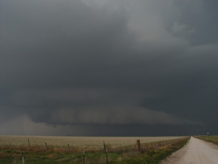
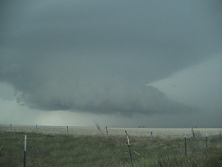
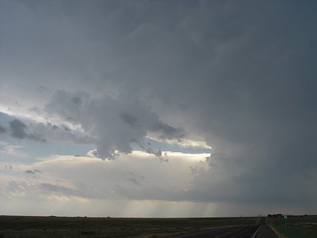
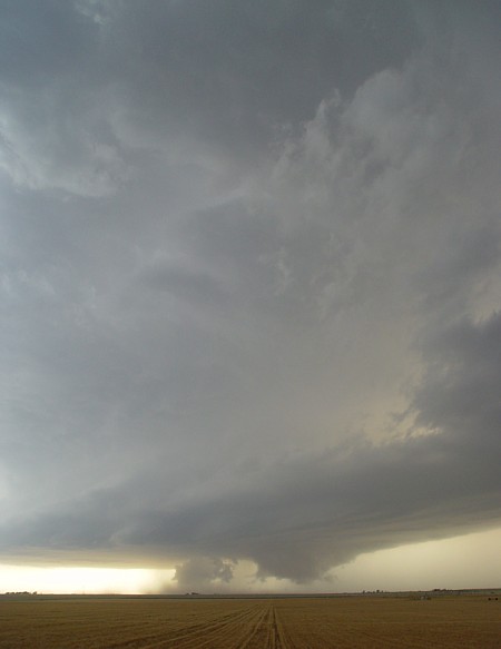
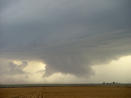
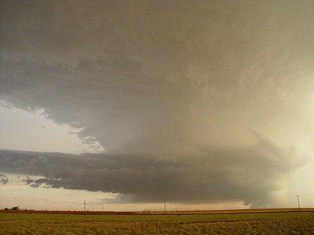
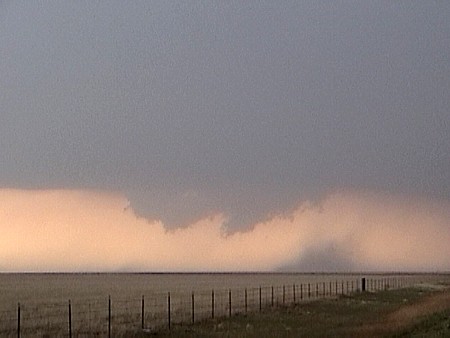
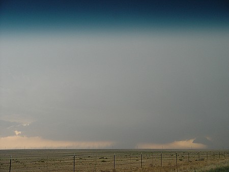
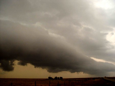
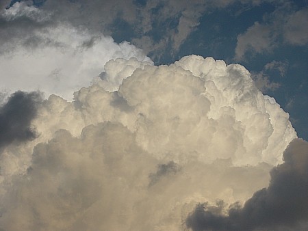
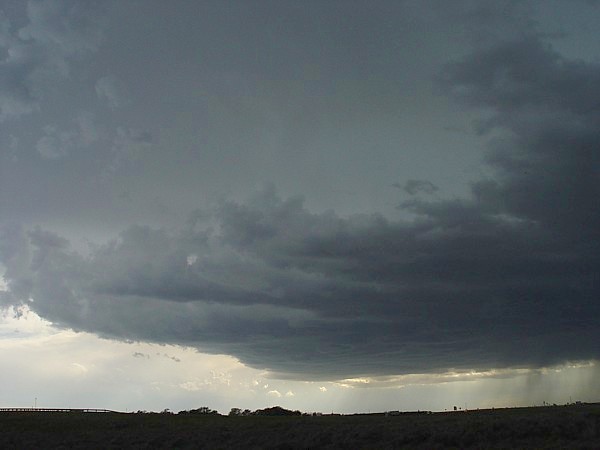
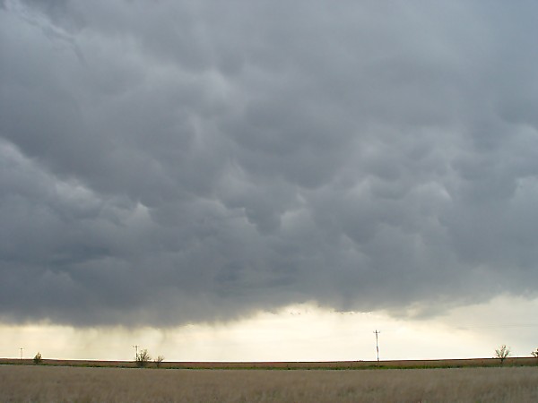
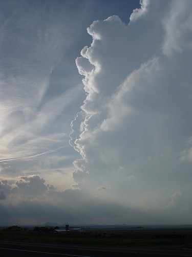
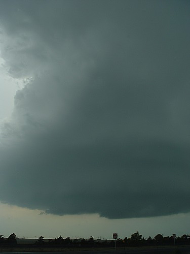
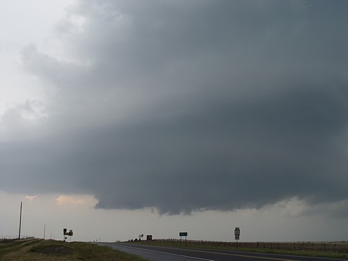
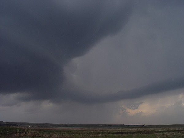
5-15-03 HIGH RISK DAY Storm Prediction Center had a high risk for most of the TX panhandle and Western OK. I think everyone was on edge on this day because of the potential for large tornadoes. Started off (at the station ) going over things with the meteorologists. The head meteorologist did a (cut in) to give the people a heads up on what was expected for the day. We went over things and although the LOW was near Clayton we thought we would (start off) SW of Amarillo near Buffalo Lake Wildlife Refuge at about 2pm. Sustained SE winds were howling at 25-30mph. Storms never got going so I went North of Hereford and sat for a while. About an hour later I met Dan Skoff and stood on the side of the road. At this time we heard of a large wedge tornado near Stratford. We stayed put because we thought storms might start firing south of this tornadic supercell. I started (seeing updrafts) to the SE at what looked to be near Canyon so I took off. Dan went East on I-40 at that time. I sat for a while and slowly drifted South to Ogg and then went East to Wayside. At wayside I started getting small hail from these storms but I let them drift on by me. I never saw anything too interesting yet. I headed up highway 207 to Claude and then went SE between Ashtola and Clarendon. At this point I pulled over because I saw (a lowering) to my W/NW. I was losing light pretty fast but I kept on taking video of this very quickly changing and VERY LOW wall cloud (image2), (image3 ), (image4), (image5). The last photo looked like it was about to produce a tornado as I watched it slowly drift NE as the dwindling sunlight made it impossible to tell if it actually did produce or not. I made my way North out of Clarendon and saw a few distant wall clouds. As I made it to I-40 I went East towards Shamrock. I heard of a very strong cell with a tornado warning on it West of Shamrock so that was my destination. As I got about 15 or 20 miles West of Shamrock I saw a (chasers vehicle) that had been turned over on it's top. When I arrived the towing crew was about to load it on their vehicle. I talked to the guy and he said that the vehicle had been turned over on it's top but the passengers were shaken up but not injured. As I continued on towards Shamrock I began noticing (semis) that had been turned over by either a tornado or straight line winds. As I neared the community of Lela, I noticed a lot of debris across I-40 and knew that a tornado had crossed the road and probably was what caused the semis to be blown off the road. I got on the access road near Lela and started taking video of the (debris), (debris2) by the road. I stayed there for a few minutes taking video as the storms slowly went NE. I decided not to go after them because it was dark and I was tired from a long day (not to mention I didn't get much sleep the night before). As I was headed Westbound towards Amarillo I noticed another (semi) that had been turned over so I stopped and got video of this. There were quite a few tornadoes on this day and I didn't see any of them. I was not disappointed because I did get to witness a tornadic wall cloud and did see some damage near Lela. If I would have been up North I would have been able to see the wedge near Stratford. If I was up North there could have been a wedge West of Amarillo. You just never know what Mother Nature may throw at you on any given day.
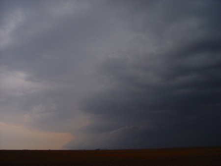
5-24-03 Storm Prediction Center had a slight risk for most of Texas and most of Oklahoma. I was headed to my parent's house on this day to eat a pre-chase meal. It just happened that the best parameters were in the Eastern TX panhandle. I left the house around 1pm and got to my parent's house which is South of Pampa at around 2:30 or so. We ate catfish and shrimp scampi (I almost forgot about chasing) and small updrafts started to (develop) north of town at around 3:30 or so. I knew at this point that the atmosphere was starting to destabilize. A few minutes later the (towers) started to get their act together. At about 6pm the (storms) started to anvil out. I drove up to a place called skyline which was right outside of town so I could get a better view of the storms. I saw a small base on one of the (storms). I then got a call from Dan Skoff who was monitoring the storms at the station and said that a storm SE of Pampa had a deviant storm motion on it and was traveling SW towards Pampa. All of the other storms were traveling to the E and NE. I proceeded to leave and headed East and then North on Ranch road 1474. As I headed North and got to highway 152 I noticed this very well defined (wall cloud)along with the tail cloud to my immediate North. I was pretty impressed with this. I stopped along the highway and started taking video (of this nice storm), (nice storm2) . I never saw much rotation with this wall cloud but it sure did look good. I headed South out of Pampa and got one final image of this (storm) which was a pretty nice shelf cloud in the distance. After taking that final image I slowly drifted back to Amarillo.
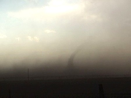
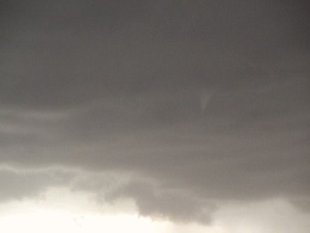
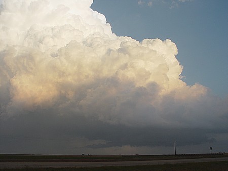
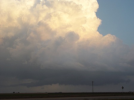
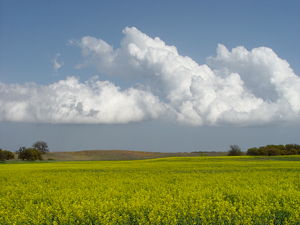
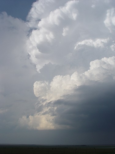
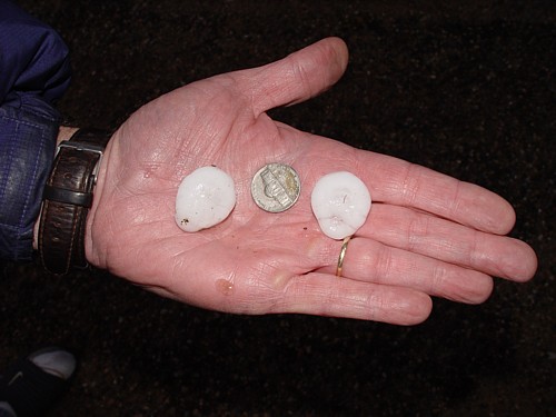
6-3-03 Storm Prediction Center had a moderate risk for all of the Western TX panhandle. I decided to go west on I-40 near Vega. I got to Vega around 4pm. I waited and waited and finally at around 5:45 I saw an (anvil) to my SW about 30 or 40 miles away. I then headed South out of Vega on highway 385 towards Hereford. When I got to Hereford I went West. I watched the (storm) for a while and then moved South a little more. The closer I got to the storm the more I began to notice the very strong inflow to the storm. I suspect the inflow was on the order of about 25-30 mph. I moved South a little more until I got to Highway 60 about 2 miles West of Friona. I continued to watch the storm with no base to speak of but the inflow was phenomenal. As I watched, I noticed a (spin-up) about a half mile or so to my NW. I then looked up and saw the (funnel) extending out of the high base. I quickly called in to the station and told them that I had a small and brief tornado about a mile or two west of Friona. This storm was moving South so I just kept up with it until it got near Sudan. It must have hit some kind of boundary near Sudan because it quickly developed a (base), (base2), (base3) and looked very impressive. I pulled over and got some good video and still shots of it and it did have a tornado warning on it at this point. I kept following it until I got near Littlefield. The storm at this point really looked good with a long extended (beaver tail ) on it. It really was impressive but I was losing light and I had to get the video back to the station so they could use it for the 10 o'clock news.
6-4-03 Storm Prediction Center had a slight risk for most of the Panhandle of TX and the best chances for tornadoes were in the Western TX panhandle and Eastern NM. I decided to go West out of Amarillo on I-40 to the town of Adrian. I sat in Adrian for at least two hours and decided to move a little more West. As I was traveling West I got a call from the chief meteorologist at the station and he told me that a storm between Forrest and Grady, NM had a hook echo on it. I made my way to San Jon, NM and then went South out of San Jon. As I got to Wheatland I saw the (storm) and it was producing a wall cloud. The wall cloud didn't last too long so I took a little video of this and made my way to Grady. As I got to Grady I went South a little but got into fairly large hail so I had to turn back North. I waited for a while and got this (photo) of the dirt being pulled up into the base. I watched this for a while but it never really looked too exciting. As I was heading home from Grady I saw another storm that had a nice (shelf cloud) and took some still shots and video of this. The storm was obviously outflow dominant so I proceeded to head home.
10-5-03 Not really expecting to chase on this day. The Storm Prediction Center had a slight risk for this day but the storms were expected just to reach severe levels with small hail and gusty winds. I looked things over and decided not to go. About 4:30 storms started to fire down by Tulia and Plainview. The storms didn't look very good on radar at that time. An hour or so later I looked at a storm on radar West of Tulia and it had a very good hook echo on it. I was stunned because all day long the storms looked pathetic and now one had a hook echo on it. I grabbed my things and just as I was about to open the door I heard a tornado warning being issued on TV. I hurried down to Tulia knowing that I was way too late. I got to Tulia about 40 minutes later and saw this (base) and began taking pictures and video. I sat just a few miles South of Tulia and took more photos (of this tornadic storm)and (shot of crisp towers) . I never saw a tornado but I did hear that the fire dept. in Tulia did spot a small tornado touch down in an open field. I know, you ask, where are the 2004 chase summaries? I have to get them on here sooner or later. I got lazy last year. This year you can count on all of my 2005 chase summaries being here!!
DATE: 4-10-05
DATE: 4-17-05
DATE: 5-06-05
|